In the last four months of 2025, Geosapiens announced agreements with the managing general agency (MGA) Revau and the insurer Co-operators. At the request of the Insurance Portal, Geosapiens presented its platform and its usefulness for underwriters in assessing flood risk.
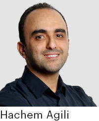
The interview with Hachem Agili, President and CEO of this provider of climate risk modeling solutions, took place at Geosapiens' offices in Quebec City. Since its founding in 2017, following the first major floods that affected southern Quebec, particularly in the Outaouais and Montérégie regions, the company has been working on hydrological flood modeling. “We saw a real lack of data availability. In the insurance industry, everyone is talking about problems with accuracy and reliability of data for decision-making, pricing, and claims management,” says Agili.
Flooding is the most costly risk in terms of claims for insurers, and this is true in Canada and elsewhere in the world, he adds. The first insurance company to show interest in the company's efforts was Co-operators. The model developed by Geosapiens covered most of Quebec and Ontario, the St. Lawrence Valley, and the Great Lakes region. "They tested the model and saw the difference," he says.
Subsequently, Co-operators invested in the company's development to help it model flood risk across all of Canada. "Our models are much more accurate and reliable than what is currently available on the market. We are the only Canadian company that offers this type of product. All our competitors are from the United States or the United Kingdom," Hachem Agili says.
According to him, the accuracy of the assessment provided by the Geosapiens model allows for appropriate pricing of the risk. “If the rate is too high or too low, it’s dangerous for the insurer,” he says. If it’s too low, the premium won’t have generated sufficient capital in the event of a claim, and the insurer will have to draw on its reserves to compensate policyholders.
On the other hand, if it’s too high, the premium won’t be competitive. The product will be less accessible and affordable for customers, which will reduce the insurer’s business volume, explains Agili.
More variables
Not all properties near a waterway are at risk of flooding. “We have a colleague who lives less than 200 meters from a river, but the difference in elevation between her property and the waterway wasn’t taken into account by the insurer, who refused to assume the risk. Our model allows us to consider the topography,” underlines Agili.
Geosapiens' flood risk assessment model, whether for rain, river, or coastal flooding, comprehensively covers the entire Canadian territory, regardless of the size of the waterway or watershed. A risk rating is suggested, allowing insurers to assign a premium to each property.
Examples: The platform takes infrastructure into account, such as the presence of dikes. In British Columbia in 2021, successive atmospheric rivers caused a large volume of rainfall, and several dikes failed, recalls Agili.
In Quebec, the same situation occurred with the Sainte-Marthe-sur-le-Lac dike in 2019. "We use data from these events to feed our rain flood model," he says. "We compare our predictive models with insurers' data based on their claims history. For natural disasters, insurers want to avoid concentrating clients in a single location because the risk is highly correlated with geography,” adds Agili. Before accepting a new risk, the underwriter can therefore check the number of clients the insurer covers in a given area.
“In cities, the risk of conflagration during a fire is very high; it’s a factor that shouldn’t be overlooked when diversifying risks like fire,” he explains. For each risk rating, the underwriter can take a screenshot and save it in the client’s file.
Geosapiens experts work on both the content—analyzing existing data to provide a risk rating based on the hazard—and the platform—integrating it according to the client company’s capabilities and needs. Agili emphasizes the extensive expertise of his team, composed of engineers, geomatics specialists, and statisticians, particularly that of his head of research, Chiranjib Chauduri, a specialist in hydroclimatic risk modeling.
“Our goal is to offer insurers the most accurate valuation of the risk represented by a given client. Subsequently, each insurer manages this according to its business strategy. Some are willing to insure everyone, while others prefer to be more selective,” says Agili.
The partners
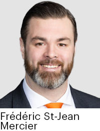
Contacted by the Insurance Portal, Frédéric St-Jean Mercier, Chief Information Officer (CIO) at Revau, states that the solution offered by Geosapiens “provides much greater precision than those of its competitors.” The MGA’s underwriters are able to delve deeper into flood risk analysis.
Furthermore, “it’s a Quebec company that is quite dynamic. For us, that’s important, he says adding, “this also allows us to collaborate with them on co-development.” The Geosapiens application has thus been adapted to better integrate with the NGIN platform that Revau subscribers use to analyze risks proposed by brokers.
This type of collaboration would not have been possible, he says, with the solutions offered by large international companies specializing in risk management. “It’s more difficult to scale platforms that are used all over the world,” he explains.
When the partnership was announced in September 2025, Revau had already been using the data provided by Geosapiens for a year. “The agreement allows us to align our respective technologies so that they work seamlessly together,” he says.
Underwriters therefore have access to mapping data and can switch between systems to assess, for example, the specific risk of each facility within the same company. The different layers of the Geosapiens platform make it possible to distinguish between different types of risks.
“The underwriter uses the same tool to prepare their case analysis, and that speeds up the process. The time savings are quite significant,” he explains. The ability to respond more quickly to broker proposals is a good thing, but the advantage also lies in the accuracy of the data. “We represent different insurers. It’s clear that the more data we bring into our underwriting process, the more we increase our analytical capacity and the fairer the pricing we can obtain for the risk.”
For an underwriting MGA like Revau, this improved risk selection helps limit losses. “We want to ensure that we underwrite good risks for the insurers we represent,” he says. The coverage of all of Canada offered by Geosapiens is useful for an MGA like Revau. Furthermore, its partner has plans to develop a solution for the US market, where Revau has been established since 2025. The partnership between the two firms could then be strengthened to develop the MGA’s capabilities in that market, he concludes.
At the insurer's side
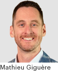
For Co-operators, the use of Geosapiens' experts is currently limited to flood risk. In an interview with the Insurance Portal, Mathieu Giguère, Vice-President of P&C Business Intelligence and Chief Analytics Officer at the insurer, explains the nature of the partnership established with the Quebec City-based firm.
"Our underwriters don't work with the platform they showed you. We use their flood risk assessment model," he says. The resulting data is used with other tools to which Co-operators has access. "This allows us to make our own risk assessment and then incorporate it into our pricing systems." The insurer can also use the model to assess the impact of flood risk on its client base, thereby diversifying the risk of losses by avoiding insuring too many clients in the same area.
The insurer can also use the model to assess the impact of flood risk on its client base, thereby diversifying the risk of losses by avoiding insuring too many clients in the same area. Co-operators already had other flood modeling system providers, and their effectiveness varies depending on the region where the client is located. “This allows me to have a little more credibility or accuracy given the different regions I look at in Canada,” notes Giguère.
Geosapiens’ ability to provide a risk rating across Canada is an advantage for Co-operators, he continues. “We are a Canadian company. Our mission is the financial security of Canadians and their communities.” If, for the same address, the different models produce very different risk assessments, the underwriter must dig deeper to find the most realistic risk assessment. When asked if he is satisfied with the accuracy of the data provided by the Quebec City-based company, Mathieu Giguère replies: “Absolutely!” The insurer cannot ignore data from international risk assessment platform providers, he adds. “But at Geosapiens, their focus is on Canada…We are a company that insures Canadians, not people around the world,” underlines Giguère.
With its CHARM (Climate Hazards & Advanced Risk Modelling) team, Co-operators is developing its own expertise in climate risk analysis. The knowledge developed through collaboration with its various partners is useful to both the company and its policyholders, adds Giguère.
“Our goal is truly to help the company, but also Canadians in general, to better understand climate risk and then reduce it as much as possible. We need to move away from a cycle of compensating insured losses and toward a cycle of prevention.”