
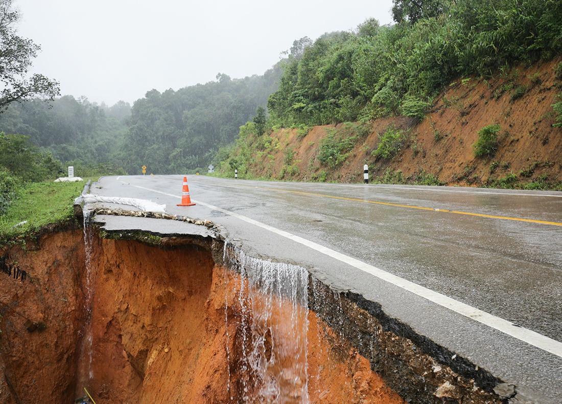
Authorities are increasingly identifying areas exposed to landslides. Yet, despite annual costs estimated by Natural Resources Canada at between $200 and $400 million, this risk remains essentially excluded from the Canadian insurance market.
Close to 3,600 homeowners in Shawinigan, Quebec recently discovered that their houses are now located in a constraint zone associated with landslides. For some, the consequences were immediate: difficulties refinancing or selling their property. The Quebec government regularly updates its maps to guide regional county municipalities (RCMs) on land-use planning and development measures, including whether to grant building or renovation permits in higher-risk areas.

“These maps are provided to municipalities, which are required to take them into account in their development plans,” underlines Jacques Locat, Professor Emeritus in the Department of Geology and Geological Engineering at Université Laval.
“If we look at the details, it is still possible to build in areas deemed at risk, but property owners will have to demonstrate that the proposed project ensures the site’s stability,” explains Locat, who is the founder of Université Laval’s Laboratory for Studies on Natural Hazards. “And to do this, they will need to call upon geotechnical experts and engineers.”
An evolving risk
Studies predict an increase in ground movements due to climate change, particularly with the intensification of precipitation and the thawing of soils. In the Vancouver area, for example, landslides could become three times more frequent within fifty years, warns an article in the scientific journal Geomorphology.
Jacques Locat, however, offers a more nuanced perspective. “Rainfall will displace a relatively thin layer of soil, but very large, deep landslides are much less affected by heavy rainfall,” he notes in an interview.
He mentions that approximately 40% of the landslides recorded over the past decade are attributable to human activity, which “plays a significant role” in the occurrence of this type of disaster.
“Naturally, embankments are formed by river erosion over centuries. A balance is established. If humans intervene at the top by adding an extra layer of soil, it can create a landslide if the slope at the bottom is widening,” the scientist explains.
Insurance: Several conditions must be met
Currently, there is no insurance coverage in Canada for these generally unpredictable disasters.
Victims can be compensated through government programs. Each province has financial assistance programs for communities after a disaster. The terms and conditions vary from one province to another.
In many cases, the authorities will activate the compensation program following a specific disaster to support victims with their temporary relocation and to meet their immediate needs. The amounts are also capped and generally do not cover the full value of the damages.
According to the Insurance Bureau of Canada (IBC), hazard mapping alone is not enough to make a risk insurable. It is also necessary to be able to assess its frequency and severity using sufficiently robust data. “To be insurable, a risk must be reliably assessed in terms of the probability, frequency, and severity of damages, based on solid data…Government mapping doesn’t perform this actuarial analysis,” explains Debbie Jussome, Public Affairs Advisor at the Insurance Bureau of Canada (IBC), in an email.

“To be insured, you can’t know when a disaster will occur; otherwise, it’s no longer a risk, but a certainty. Therefore, you need to be able to estimate the frequency and severity of the hazard in relation to the insured assets in the territory and their vulnerability to damage,” notes Michael Bourdeau-Brien, Associate Professor, Department of Finance, Insurance and Real Estate at Université Laval.
In an interview with the Insurance Portal, Bourdeau-Brien, who is also holder of the AMF Fund for Research on Financial Institutions’ Integrated Risk Management, adds that beyond mapping a specific type of hazard, insurers need a sufficient customer base to make the service profitable. “Without a large enough number of insureds, the insurer cannot collect enough premiums to pay out claims.”
The potential cost of the premiums themselves could discourage individuals from purchasing insurance to protect the value of their property from landslides, if it were offered, he adds.
“There are government financial assistance programs available to disaster victims that are perceived by the public as free protection. Would households be willing to pay more for better coverage?” he asks.
Insurable elsewhere in the world
To be accessible to more households, this costly insurance would require the collaboration of several stakeholders. “Rather than excluding coverage in certain areas, several insurers in the United States offer ‘catastrophe bonds’ with major international investors,” explains Bourdeau-Brien.
“Even in countries with limited government intervention, like the United States, we are starting to see several types of hazards where governments have stepped in to replace or supplement private insurance,” Bourdeau-Brien points out. He believes this is a model that should be further developed in Quebec and the rest of Canada.
In France, Bourdeau-Brien adds, all property and casualty insurance policies include a 20% surcharge to compensate victims of natural disasters. The surcharge rate is reviewed every five years to account for the evolving nature of hazards due to climate change.
This model is also applied in Switzerland, where the entire country is insurable. The natural perils insurance program, established in 1936, relies on preventative measures, collective surcharges, and government support. The natural perils compensation fund (Elementarschaden-Pool) is financed by a dozen insurers. In the event of a disaster, 80% of the damage costs are covered by this fund, with the policyholder's insurer covering the remaining 20%.
In Norway, too, landslides are considered an insurable risk. In 1980, the country established a program called the Norwegian Natural Perils Pool (Nork naturskadepool), to which all insurers offering fire coverage are required to contribute proportionally to their market share. This sum is taken from a surcharge imposed on policyholders and is used to compensate those affected by a disaster attributable to a natural catastrophe, including landslides.
Jacques Locat believes that the creation of a similar program could be applicable to Canada.
"Their territory is…very similar to ours: we have the same geology,” he explains. “It’s composed of the same clays, it experienced the same ice ages, and we find the same trees and the same mountain rocks.”
Finally, New Zealand benefits from a program similar to those found in Europe. The Earthquake Commission, established in 1945, transitioned to the Natural Hazards Commission Toka Tū Ake to address all hazards occurring within its territory. Again, a compensation fund is financed by surcharges.
In the event of a disaster, this fund offers maximum compensation of NZ$300,000 (approximately CA$150,000); the remainder of the claim is covered by the policyholder’s insurer.
Over the past five years, 13,000 claims have been filed with this fund for damages attributable to landslides.
In Canada, landslide hazard mapping now allows for more precise identification of the zones most vulnerable to landslides. While such knowledge alone is not enough to make landslide risk insurable, experiences elsewhere in the world demonstrate that there is potential to shift some of this risk into the commercial market.