
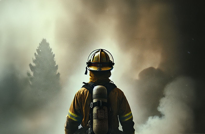
Wildfires are raging across several Canadian provinces in 2026. Residents of a number of Indigenous communities in northwestern Ontario had to be evacuated in mid-July.
As of July 19 in Canada, according to data from the Canadian Interagency Forest Fire Centre (CIFFC), the approximately 3,854 recorded wildfires had burned more than 2.9 million hectares of forested land, primarily in the Northwest Territories, which accounted for 25.9 per cent of the affected area, followed by Ontario (25.2 per cent) and Quebec (24 per cent).
Not every wildfire causes significant damage. According to research conducted in the United States, between 2001 and 2020, only 2.7 per cent of recorded wildfires caused damage, mainly because of the speed at which they spread.
The Institute for Catastrophic Loss Reduction (ICLR) hosted three U.S. experts specializing in wildfire detection and suppression on July 10 as part of the webinar Turning Wildfire Intelligence Into Homeowner and Community Action.
The webinar provided an opportunity to learn more about the tools available to communities in California and the northwestern United States to better prepare for wildfires. When they become uncontrollable, as seen in the Los Angeles area in January 2025, they can turn into major catastrophic losses.
Jason Brooks, founder of Fire Aside, develops practical solutions and tools to help communities and homeowners better understand vegetation fire risk and improve their preparedness. He works in the San Francisco Bay Area in California, the most populous U.S. state, which has been hit repeatedly by major wildfire-related disasters over the past decade.
Brooks presented maps produced by XyloPlan, a company founded by Dave Winnacker. Winnacker retired as a firefighter in December 2024 while serving as chief of the Moraga-Orinda Fire District, located about 15 kilometres east of San Francisco.
Technology now makes it possible to model wildfire risk and even measure and isolate risk on a home-by-home basis. Within the same neighbourhood, communication strategies can therefore be tailored according to the specific level of risk on individual streets.
Tailoring the message
For example, Brooks showed a map of a mid-sized California municipality. In the northeastern section, where homes border agricultural land, he suggested limiting communications to informing homeowners about the danger posed by wind-driven embers. In those areas, residents can be helped by modifying ventilation systems to prevent embers from entering the home and igniting a fire.
In the more densely populated section of the municipality, where single-family homes sit on relatively small lots, communication efforts should be strengthened and incentives offered to encourage mitigation measures that limit fire spread.
In the southeastern part of the same neighbourhood, one row of six homes requires each homeowner to be approached individually and supported in mitigation efforts. According to XyloPlan’s modelling, if just one of those homes catches fire, the neighbouring homes are likely to follow, creating a very high risk of conflagration because of their strategic location.
Brooks stressed that prevention and public awareness campaigns have only limited effectiveness. People are more likely to pay attention if they have already experienced wildfire risk themselves or if someone close to them has. Otherwise, prevention has its limits. Not all homeowners respond at the same pace to messages promoting mitigation.
“For every resident in these communities who has reached resilience, the process has taken several years and it’s been a multi-step journey. Very few people just simply do everything at once,” he said. The challenge is that if neighbours fail to act, people’s motivation to take the necessary steps declines.
Brooks suggested that one strategy is to encourage entire neighbourhoods to focus on one task at a time. For example, residents can identify shrubs and bushes close to homes, as these can ignite quickly when winds pick up. Communities can also help homeowners install ember-resistant mesh over ventilation openings.
Support provided by the community must be adapted to the capacity and willingness of homeowners and tenants. Some mitigation measures may not be appropriate in neighbourhoods with older residents living in manufactured homes. Some people have the financial means but lack the motivation. Others are willing to act but do not have the financial resources.
In some cases, municipal authorities can adopt measures requiring homeowners to mitigate their risk by enforcing municipal bylaws against violations that threaten neighbouring properties. In California, residents can determine their property’s wildfire vulnerability online simply by entering an address.
Dave Winnacker emphasized that awareness efforts cannot be the same for isolated homes in rural or forested areas as they are for urban neighbourhoods.
“When these approaches are simply transferred into dense urban and suburban environments, where most of the structure losses have occurred over the past twenty years, they don’t do well because they fail to account for the network effect of fire spread from structure to structure,” he explained.
Wind is the enemy
Some 97.3 per cent of wildfires cause no damage, Winnacker said, citing research by Jack Cohen of the United States Forest Service research laboratory. What is the tipping point? According to Cohen, once a fire burns 1,620 hectares (4,000 acres) in a single day, it reaches an uncontrollable scale.
During his presentation, Winnacker showed a photograph of a fire near a McDonald’s restaurant in January 2025, where strong winds carried embers over very long distances while also supplying the oxygen that fuelled the blaze. A single ember is not enough to ignite a structure, but a blizzard of embers certainly can.
Once one house burns down, neighbouring homes become highly vulnerable, and firefighters’ priority is to prevent an urban conflagration.
If one house is on fire, the crew from one fire station can put it out. If ten houses are burning at the same time, things become much more complicated, says Winnacker.
Ralph Bloemers is a filmmaker, lawyer and wildfire prevention specialist. Several of his videos are available on the Fire Safe People YouTube channel.
One features John Clarke Mills, a wealthy internet entrepreneur who purchased a large remote property in Sonoma County, California. One day, a wildfire broke out nearby, but it took him some time to realize what was happening because his home was shielded by the area’s unique topography. Mills observed firsthand how difficult communication between wildland firefighters and affected residents could be.
The tools exist
Bloemers pointed out that during the Altadena fires in January 2025, many structures ignited because debris from overturned curbside waste bins caught fire after the bins had been blown over by strong winds. He recommended consulting the resources produced by the Insurance Institute for Business & Home Safety (IIBHS) to better prepare the immediate surroundings of a home.
“Removing vegetation in the first five feet is tough for people, because the’re pretty attached to that stuff,” Bloemers noted. “You don’t necessarily need to get rid of your trees, only overhanging branches. Very few homes are ignited by a tree on fire. ”
Winnacker urged the insurance industry not to undermine homeowners’ efforts to better protect their properties against wildfire. Insurers already use risk models for every insured peril, including wildfire, to determine homeowners’ insurance premiums. In his view, those same models could also take homeowners’ mitigation efforts into account.
“If people do the mitigations that matter, they prevent embers from becoming flame, and they prevent their house from igniting,” Bloemers insisted. By doing so, they reduce the spread of fires in urban areas.
The required investments may seem significant, but they are far less costly than rebuilding a community destroyed by fire, Winnacker noted. The severity of wildfire damage results from the combination of topography, weather conditions and available fuels, he added. During prolonged droughts, public authorities must step up warnings urging people to exercise caution.
"By defining the problem and the solution very crisply, insurers put themselves in a position to signal to policyholders what you care about,” Bloemers said. The average homeowner does not understand the risk associated with wildfire. For the message to resonate, people must be concerned enough to feel personally affected, particularly through pricing.
“Wildfire is inevitable. Disaster is not. Communities have choices. When neighbours prepare together, their homes survive and communities can recover. Agency remains with the people who live in these communities,” Bloemers concluded in a memorandum distributed by the ICLR to webinar participants.
A Canadian example
Bloemers encouraged Canadians to look at the work of Alan Westhaver, who launched his own consulting firm after a 30-year career with Parks Canada. Westhaver studied wildfire behaviour in populated areas to better understand why one home burns while the neighbouring one survives.
He visited the community of Fort McMurray, where the May 2016 wildfire became the costliest disaster in Alberta’s history. The October 25, 2017 episode of The Nature of Things, titled Into the Fire, was written and directed by documentary filmmaker Leora Eisen and features the former Parks Canada researcher.
In the first 30 minutes of the documentary, which is easy to find on YouTube, Westhaver explains the observations he made in Fort McMurray a few weeks after the 2016 wildfire. Those observations enabled him to recommend measures homeowners can take around their properties to prevent fire from spreading.
Several scenes in the documentary were filmed in British Columbia in 2017, a year marked by severe wildfires. Approximately 1.22 million hectares burned in the province that year, a record that was later surpassed in 2023, when 1.35 million hectares were destroyed.
Over the past 25 years, CIFCC reports that Canada has recorded an annual average of approximately 3,807 wildfires, with an average cumulative burned area of 1,935,202 hectares.