On Sept. 19, the World Resources Institute published City-Scale, City-Relevant Climate Hazard Indicators Under 1.5°C, 2.0°C, and 3.0°C of Global Warming, a research paper based on an analysis of projections of the effect of extreme weather events associated with global warming in 996 cities with more than 500,000 residents in 2015.
It assesses the recurrence and amplitude of 14 types of climate hazard indicators under various scenarios of global warming, at 1.5°C, the limit set by the Paris Climate Agreement, and also at 2°C and 3°C, compared with the average temperature of the 1880-1900 period.
For each city, the authors also estimated the likelihood of hazard magnitude values exceeding particular extreme threshold values. The hazards were chosen to take into account climate adaptation decision-making in the areas of public health, infrastructure maintenance and economic productivity.
These projections include eight Canadian metropolitan areas: Vancouver, Calgary, Edmonton, Winnipeg, Toronto, Ottawa, Montreal and Quebec City. Modeling results were compared with perils covering the historical reference period, 1995-2014, where average warming reached 0.81°C in 2005. Air temperature is measured at a height of two meters.
Precipitation volume
Ten of these hazards are related to temperature, and four to precipitation volume. The authors point out that the projections do not take into account the risk exposure of each agglomeration in terms of its demographic, socio-economic or geographical characteristics, or its capacity to adapt to climate extremes.
For example, they project the hottest temperature, the number of days in the year when the mercury exceeds 35°C or 40°C, or when heat exceeds critical thresholds. They also forecast the number of days when the maximum temperature exceeds the 95th percentile of the temperature recorded in a city between 1980 and 2019, or the days when a building needs to be cooled by air conditioning.
The impact of heatwaves, both their number and duration, is also assessed, as are the number of days when temperatures are optimal for malaria outbreaks or the transmission of arboviruses by mosquitoes or ticks. Increased warming will favor arbovirus transmission.
For precipitation, the paper evaluates the day with the most rainfall in a single day, the number of days with no precipitation at all, hence drought, the number of days with precipitation amounts exceeding the 90th percentile recorded between 1980 and 2019, and finally the days with a high risk of landslides.
For each of these 14 hazards, the authors determine an expected hazard value and the probability of the hazard value exceeding a specified critical threshold in any year of the 10-year period.
Each warming scenario involves a projection based on nine different forecasting models, three of which were selected for each of the urban areas.
Trends
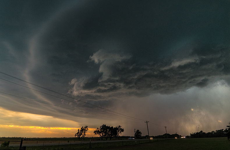
According to the authors of the World Resources Institute paper, global trends emerge from an analysis of the projections. For example, in terms of heatwave duration, the unweighted average for all cities is 14.2 days for the period 1995-2014. This rises to 16.3 days in the 1.5°C scenario and 24.5 days in the 3°C scenario.
The average resident of these 996 agglomerations will experience a 53% increase in the number of heatwave days if warming increases from 1.5°C to 3°C. The number of heatwave episodes also increases as warming accelerates.
The probability of such events remains variable according to the average income of the population in the country concerned. The unweighted average number of heatwaves increases by 29% when moving from the target scenario to the worst-case scenario.
The paper also includes explanations of the limitations of forecasting models, including the impossibility of considering heat islands, which are common in many cities where soils are sealed and vegetation is scarce. Nor do the authors consider the growing urbanization and probable expansion of these urban areas. Exposure to hazards is estimated on the basis of the current population, not possible future growth.
They also point out that within the same urban area, depending on the size of buildings, the percentage of vegetation cover and the presence of a body of water, there can be considerable climatic variations. The authors also point out that variations are probably underestimated, particularly where precipitation is concerned.
However, even with limited data availability, the researchers found that a world 3.0°C above the pre-industrial baseline would probably be much worse for many more city dwellers than a world where the temperature climbed by only 1.5°C.
The average resident of these 996 cities will experience a 53% increase in the number of heatwave days if warming increases from 1.5°C to 3°C. The number of heatwave episodes also increases as warming accelerates.
The probability of such events remains variable, depending on the average income of the population in the country concerned. The unweighted average number of heatwaves increases by 29% if we move from the target scenario to the worst-case scenario.
If we move from the 1.5°C scenario to the 3°C scenario, urban areas located in countries with low average incomes will experience a 45% increase in heatwave episodes, while city dwellers in countries with high average incomes will experience a 14% increase.
Across all urban areas and based on 2020 population estimates, at the targeted 1.5°C scenario, the researchers estimate that 547 million city dwellers will be exposed to 30 or more days of temperatures exceeding 35°C. If the worst-case scenario materializes, this number rises to 701 million.
The paper states that when interpreting the data, users should be cautious about the spatial distribution of indicators. Near the equator, the equivalent of 0.25 degrees difference in latitude or longitude is equivalent to 28 kilometers. As a result, the same area can include both highly urbanized portions and the surrounding countryside. As a result, the projected average is likely to be lower than that actually experienced in city centers.
Air quality
In its Air Quality and Climate Bulletin published on Sept. 4, the World Meteorological Organization (WMO) stated that “a vicious cycle of climate change, wildfires and air pollution is having a spiralling negative impact on human health, ecosystems and agriculture,”.
According to the WMO, ambient air pollution is responsible for over 4.5 million premature deaths per year. The bulletin analyzes the complex relationship between air quality and climate. It is based on the first eight months of 2024, which were marked by continuity in the trends observed in 2023. Intense heat and persistent drought increase the risk of forest fires and air pollution.
The chemicals responsible for air pollution are generally emitted at the same time as greenhouse gases. Thus, global warming and deteriorating air quality inevitably go hand in hand, explains the WMO.
Atmospheric pollutants are deposited on the Earth's surface. Poor air quality then affects the health of ecosystems. Deposits of nitrogen, sulfur and ozone reduce the services provided by natural ecosystems for clean water, biodiversity and carbon storage, the WMO adds.
The bulletin lists global concentrations of fine particles, particularly PM 2.5 (particles with a diameter of no more than 2.5 micrometers). These are particularly harmful to health if inhaled over long periods. These particles are emitted by the combustion of fossil fuels, forest fires or wind-blown desert dust.
In 2023, forest fires in North America, particularly in Canada, resulted in exceptionally high emissions of the same particulates compared with the period 2003-2023.
For agricultural production, these same emissions are reducing crop productivity in countries where high yields are required to feed their populations. The WMO notes that this situation is particularly acute in Central Africa, South-East Asia, China, India and Pakistan. In the most polluted areas of China and India, crop yields have been reduced by 15%.
Airborne particles reduce the amount of light that plants can absorb. “Agriculture itself is a major contributor to emissions of particles and their precursors from stubble burning, fertilizer and pesticide application, ploughing, harvesting, and manure storage and use”, explains the WMO.
The chemicals responsible for air pollution are generally emitted at the same time as greenhouse gases. As a result, global warming and deteriorating air quality inevitably go hand in hand.
Atmospheric pollutants are deposited on the Earth's surface. Poor air quality then affects the health of ecosystems. Deposits of nitrogen, sulfur and ozone reduce the services provided by natural ecosystems in terms of clean water, biodiversity and carbon storage.
This article is a Magazine Supplement of the December issue of the Insurance Journal.